


Themed trails
Around Galtür
On the occasion of the state exhibition 05, existing hiking trails were expanded in content and developed into themed trails. A visit to Galtür should definitely be combined with such a hike. On the paths of these trails, you learn a lot of odd and interesting facts about Galtür.
Interesting facts about the high Alpine flora and fauna around Galtür (a project of the Galtür elementary school)
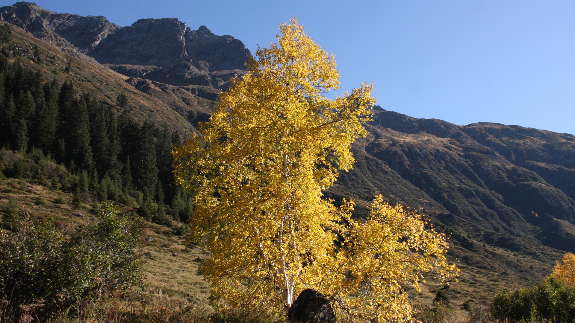
Experience the forest
This path has information about plants and animals in the Alpine forest, about avalanche protection, afforestation and about the recycling or processing of the wood. Viewpoints and panoramic views round off the interesting circular route. Sturdy shoes are recommended. The hike takes 2 to 2½ hours.
Stations along the thematic trail
Former power station in Galtür - “Guggermühle” mill - Hexenloch (“witches’ hole”) - flowers - alder, birch - Böschalift - significance of the forest - ants - avalanche control - reforestation - roe deer, deer, game feeding - the tree - spruce, larch, squirrels - Alpine roses - view of Galtür - berries - avalanche protection walls - Hochstreitboden area - fox, marten, badger - sycamore - sawmill - wood processing - mushrooms - insects - birds - farms in the "Stana" area - view of the Jamtal valley to the glacier
Hexenloch (“witches’ hole”), Gumpbrunnen (“pump well”), Deichelleitung (“wooden pipes”) - in search of water - water usage then and now
In search of water
The expressions “Hexenloch - witches’ hole”, “Gumpbrunnen - pump well” and Deichelleitung (“wooden pipes”) seem almost fairytale to us today. This thematic trail is intended to give an insight into the secrets of these terms. Visitors learn interesting facts about the extraction and use of water in the municipality of Galtür, then and now. Sturdy shoes are recommended. The hike lasts 1½ hours
Stations of the "In search of water" theme trail
Schnapfengasse - Hexenloch (“witches’ hole”) - the water supply from Galtür with the elevated tank to Gaffelar - Galtür sports centre - Gumpbrunnen (“pump well”) - drinking trough, Deicheln (“wooden pipes”) - Walserhaus - Kneippwal.

Strength for the mind, body and soul, a visit to the church, hikes to the chapels of Galtür.
Path of Reflection
Strength for the mind, body and soul, a visit to the church, hike to the chapels of Galtür. In addition to the parish church, numerous chapels and shrines have been built in Galtür over the centuries, embedded in the wonderful mountains of Silvretta as a testimony of deep faith. The Path of Reflection is an invitation to let go, experience nature and search for the walls within yourself. The Path of Reflection begins at Zeinis and ends at the forest chapel. The hike lasts around 2 hours.
Stations of the Path of Reflection:
St. Antoniuskapelle - Rearkapalli - Lourdeskapelle - Judas Taddäus - Marienkapelle Gafelar - Marienkapelle Hochegg - Marienkapelle Poart - Marienkapelle Maria Hilf - St. Martin Kapelle - Marienkapelle Stana - Parish Church of the Nativity of Mary (“Pfarrkirche Maria Geburt) - forest chapel (“Waldkapelle)
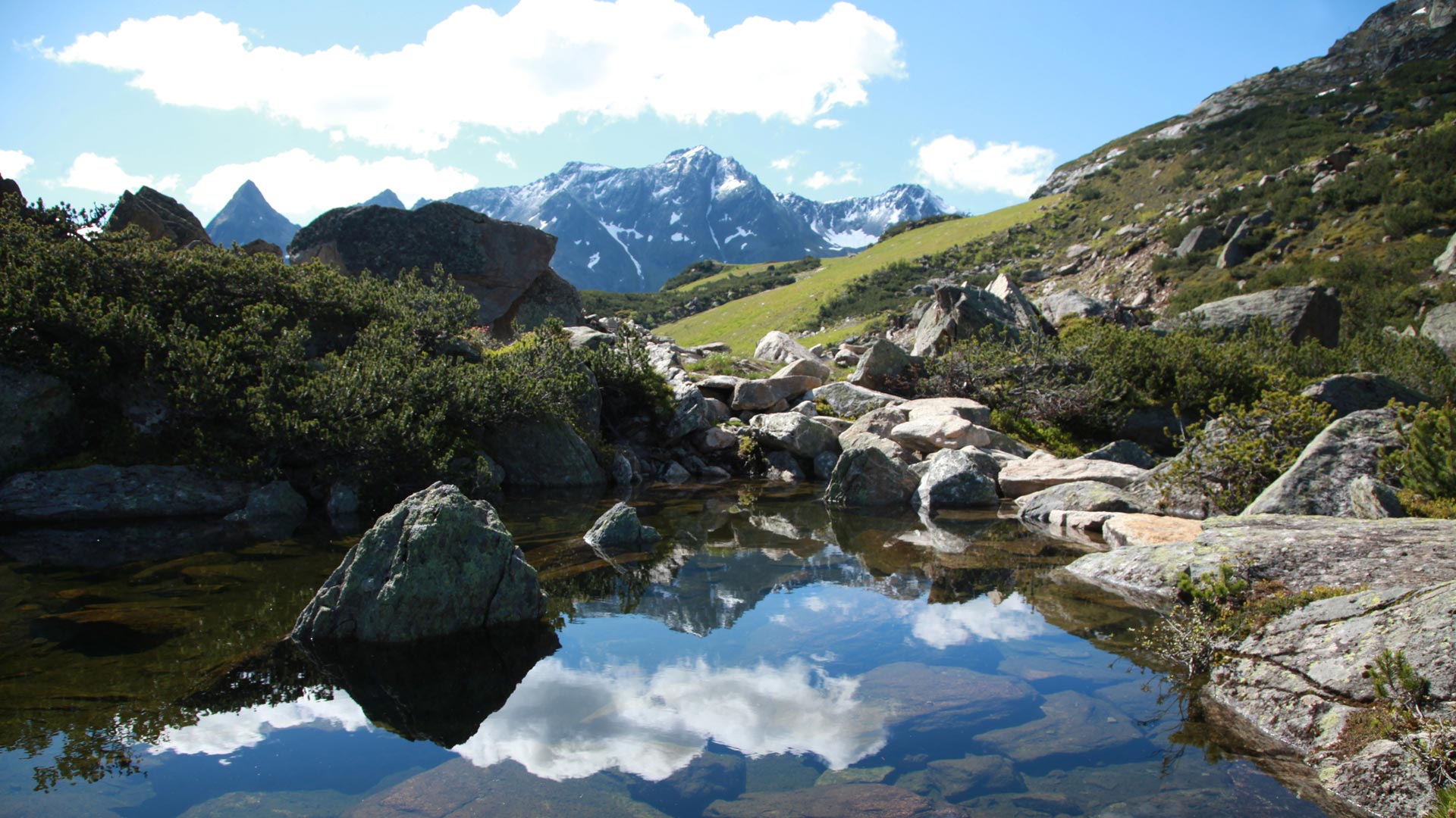
Explore the changing landscape (“Vom Wandel der Landschaft”) - from the mountain meadow to the battle zone of the forest up to the peaks of the mountains
1,000 m - elevation meters
Explore the changing landscape ((“Vom Wandel der Landschaft”) ) - from the mountain meadow to the battle zone of the forest up to the peaks of the mountains
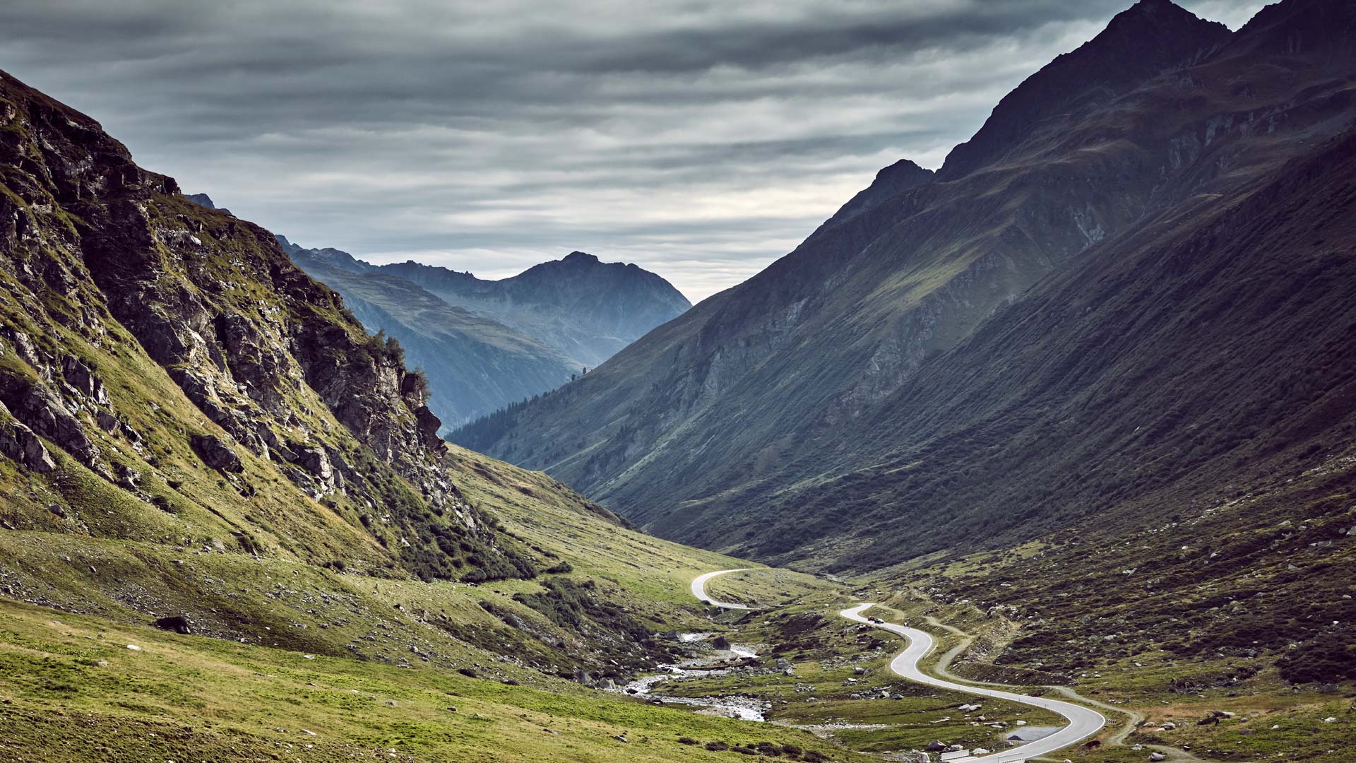
This themed trail goes from Galtür to the "Grieskogel". It was created by employees of the Torrent and Avalanche Control and starts at the meadows on the valley floor, rises steeply to the mountain meadows and runs across barren pastures to the wasteland near the summits. You can experience the diverse flora and fauna of the high alpine terrain. Where there were once mountain meadows and high pastures, a new forest is being created under the protection of steel snow bridges. The steepness of the terrain gives an idea of the tremendous forces that arise when avalanches are unleashed and how difficult it is to reforest the woodland. This path opens up an unforgettable view of the peaks and glaciers of Silvretta. To master the entire length of this trail, surefootedness is required.
Hike duration: 2 ½ to 3 hours.
Stations of the path with 1000 elevation meters:
The trail starts at the Alpinarium and initially takes you, via a short detour to the west, to the avalanche wall near the harrow. On the higher valley path, you hike back to the Birkenhof area. The actual 1000-metre-high trail branches off after the stream. It leads up steep terrain to the driveway on Adamsberg. From there, you can continue westwards to the avalanche barriers on the Grieskogel. To the east, you can easily get to the Friedrichshafnerhütte.